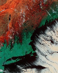
 A consortium of New England groups has received a $1.4 million grant to collect high-resolution topographical data for greatly improved flood risk maps, according to a press release from the University of New Hampshire. The project will collect data from New York City to Eastport, Maine.
This is potentially very good news for all coastal communities in the area, who will be able to use the information to make better decisions about risks in specific areas.
(NASA image)